Part 7: St Leonard’s Church Semley to St Catherine’s Church Sedgehill
Distance approx. 3.20 miles. Walking time approx. 1 hour 30 minutes.
This is part of a walk which connects all the churches in the Benefice of St Bartholomew and Wardour Chapel using public footpaths and avoiding roads so far as possible. The route, clockwise from Sedgehill, goes via East Knoyle, Wardour, Donhead St Andrew, Donhead St Mary, Charlton, Semley and back to Sedgehill.
Maps – OS Explorer 118 1:25000 scale map (2.5 inches to 1 mile). If you have an OS subscription and App the link to the map for this part of the walk is here.
Start – St Leonard’s Church, Semley, Shaftesbury, SP7 9JW (OS Grid Ref: ST 89221 26922)
Finish – St Catherine’s Church, Sedgehill, Shaftesbury SP79JN (OS Grid Ref: ST 86645 28238)
Download – This section of the walk can be downloaded as a pdf file by clicking HERE.
Facilities – There are no facilities at Sedgehill. However, Semley not only has a village shop, Semley Village Stores, opposite the church, but also a pub, The Bennet Arms (01747 830221), just across the Village Green. There is no regular or convenient public transport. Parking at Semley is available on the roads around the church and in Sedgehill in the lane alongside the church.
Guidance – The best way to follow the route is by using the Ordnance Survey maps. These maps show the footpaths and it is recommended that you use them or, better still, with an Ordnance Survey subscription (which provides access to all OS maps online and access to an App on your smartphone) you can follow the link provided above.
The extract from the map is provided here online using an OS Media Licence with the restriction that it may not be printed or copied. You will need, therefore, to trace the route shown onto your own OS map.

There is, of course, a much shorter direct route from Semley to Sedgehill by road but the intention of St Bartholomew’s Way is to avoid roads and use footpaths wherever possible. This route succeeds in doing that by a dog-leg heading north before striking west to cross the A350 and reach Sedgehill: our reward is to pass through some glorious quiet country.
Leave St Leonard’s Church by the main gate on the crossroads and turn left to walk up the road towards Donhead St Mary and Charlton past the Semley Village Stores. You are looking for a footpath sign on your right. However, this sign (next to the 30 mph speed sign and after the houses on your right) was virtually invisible in the vegetation in August (Photo 1) and the footpath impassable. Instead, follow the driveway immediately before the sign (Photo 2). You may be able to get to the stile hidden on your left, otherwise continue along the drive. Either way, you enter a garden with mown paths. Keep straight in a north-west direction passing a pond on your left to enter a field. The path is not obvious and there are no signs but have the courage of your conviction (of course) that these notes are fairly reliable and keep straight. Ignore a mown path that takes you left around the pond and look instead for a stile ahead of you. Cross this and carry on straight in a north-west direction with the lovely garden of Semley Grange visible on your left (well-worth a visit when occasionally open). Head for a line of trees and open gap with a woodpile on your left. Here you will see Glebe Farm buildings ahead on your right (Photo 3). Here you should bear slightly left heading to the far corner of the field where you will find a broken-down stile and sleeper footbridge that will take you out onto the driveway leading to the gates of Semley Grange.
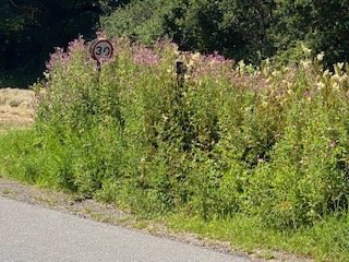
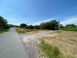
Photo 1
Photo 2
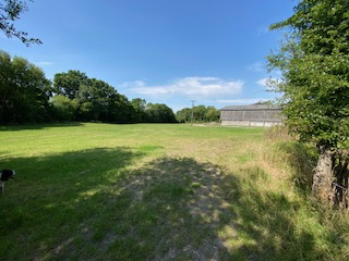

Photo 3
Photo 4
Turn right on the driveway and then right on Sem Hill ignoring the track with a footpath sign ahead of you (Photo 4). Come down the road to a T-junction with the road that runs from Semley under the railway bridge to the A350. Turn left here and then turn right up a cul-de-sac with a sign to “Grove Cottage and Belle Vue only” (Photo 5) to arrive at a pedestrian railway crossing (Photo 6). Cross carefully obeying the signs and making sure that you close the gates (there is £1000 fine if you fail to do so!). Then goes straight ahead on a concrete road until you get to Amber Leaze Farm (on your left) where you should turn right (Photo 7) down a well-maintained wide footpath between hedges and trees. Follow this path keeping straight until you get to a high 8-bar metal gate (Photo 8). Go through this and across Tokes Lane where you will find a narrow footpath continues running along the left side of Tokes Farm opposite you.
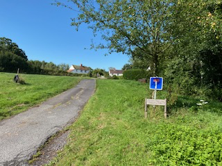
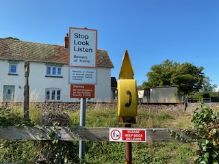
Photo 5
Photo 6
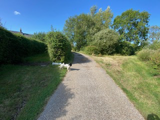
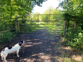
Photo 7
Photo 8
Continue on this narrow footpath in northerly direction. After a while, it opens out with a mown path to follow and a circle of standing stones on your right. After that, route finding gets a little more difficult. You will come to some trees but, rather than continuing forward, cast off to your right and find a flat stone bridge over a small brook (Photo 9) and walking forward now with the brook on your left you will come to a 5-bar metal gate (Photo 10) with a footpath sign (the first in a while – hurrah!).
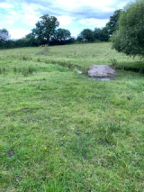
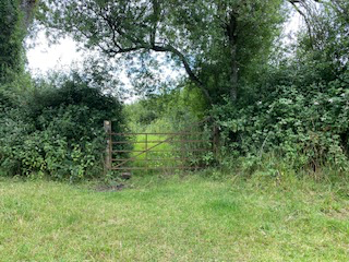
Photo 9
Photo 10
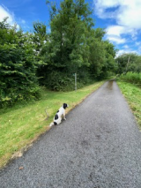
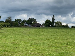
Photo 11
Photo 12
Our route to Sedgehill now heads east towards the A350. Continue straight across an open field sloping slightly downwards to a 7-bar metal gate. Go through this into another field where you will see Colemans Farm ahead of you. Keep straight aiming for the north side of the farm and go through gates to reach the A350. Cross this busy road carefully. Here, again, it looks from the OS map as though the footpath goes straight through Red House Farm. However, there is an easier permissive path that comes off the A350 on the south side of the farm. This will take you to a 7-bar metal gate the other side of a miniature railway track where you can make a safer crossing than the Waterloo to Exeter line that we crossed earlier. Unless, that is, if you are superstitious about the number of the relevant Photo (13). You now need to head slightly south of east downhill to find a stile and bridge over a brook. We are pioneering here, judging by the amount of vegetation necessary to get through in July – which suggests that nobody until then this year had passed this way (Photo 14).
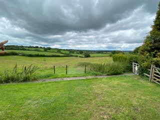
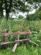
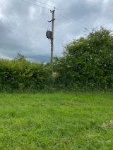
Photo 13
Photo 14
Photo 15
Continue straight to reach the south side of Corner Farm. Here the way forward is again not obvious but look for a wooden electricity pylon with a transformer (Photo 15) as a marker for a way through the hedge onto the drive of Corner Farm.
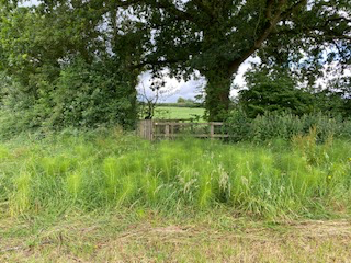
Photo 16
Photo 17
Now go through various wooden gates heading in a south-west direction and look for a large oak tree at the base of which is a wooden bridge with stiles (Photos 16 and 17). Cross this and continue to head south-west crossing and climbing a field to look for another stile in the hedge in front of you. Once across this, you should bear slightly right passing to the right of Church Farm which you will see ahead of you with new metal railings. Look for a gate in a post and wire fence (Photo 18). Go through this, passing through a small block of woodland, to emerge and find ahead of you St Catherine’s Church, Sedgehill.
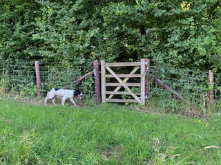
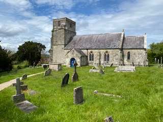
Photo 18
Photo 19
Well done! You have completed St Bartholomew’s Way. That is, if you started at Sedgehill. If not, carry on!